PARTIAL RESULTS FROM SEARCH ON " Mas*ad "
NAME DESIG. LATITUDE LONGITUDE AREA UTM JOG NO.
Mashad: see Mashhad
PPL 26䓱'00"N 62䓣'00"E IR00 MK56 NG41-06
Mashhad
PPL 26䓱'00"N 62䓣'00"E IR00 MK56 NG41-06
Mashhad [IRAN]; Mashod Pass [PAKISTAN]
PASS 27䓎'00"N 63䓂'00"E IR00 NL01 NG41-03
Mashhad
FRM 30䓓'10"N 52䓌'09"E IR07 XP15 NH39-07
Mashhad
PPL 30䓲'00"N 50䓌'00"E IR15 VQ21 NH39-06
Mashad
AREA 33䓂'00"N 46䓳'00"E IR10 PB75 NI38-12
Mashhad-e Zolfabad
PPL 34䓟'00"N 49䓦'00"E IR24 UU72 NI39-06
Mashad: see Mashhad-e Bazarjan
PPL 34䓯'26"N 49䓸'44"E IR24 VU05 NI39-06
Mashhad: see Mashhad-e Bazarjan
PPL 34䓯'26"N 49䓸'44"E IR24 VU05 NI39-06
Mashhad
PPL 35䓤'00"N 52䓝'00"E IR26 XV34 NI39-03
Mashad: see Mashhad
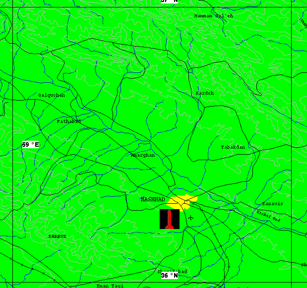
PPL 36䓒'18"N 59䓣'55"E IR30 GF32 NJ40-16
Mashhad
PPL 36䓒'18"N 59䓣'55"E IR30 GF32 NJ40-16
As of 11 April 2000 Russian 2-meter resolution KVR-1000 imagery coverage was not available via the SPIN-2 service on TerraServer, nor was archived Space Imaging IKONOS 1-meter imagery of this area available on the CARTERRA° Archive.